FOR IMMEDIATE RELEASE
CONTACT: Jennifer Flachman, Public Information Officer
flachman@cityofmerced.org, (209) 564-0235
Heavy Rainfall Forecasted with Possible Flooding
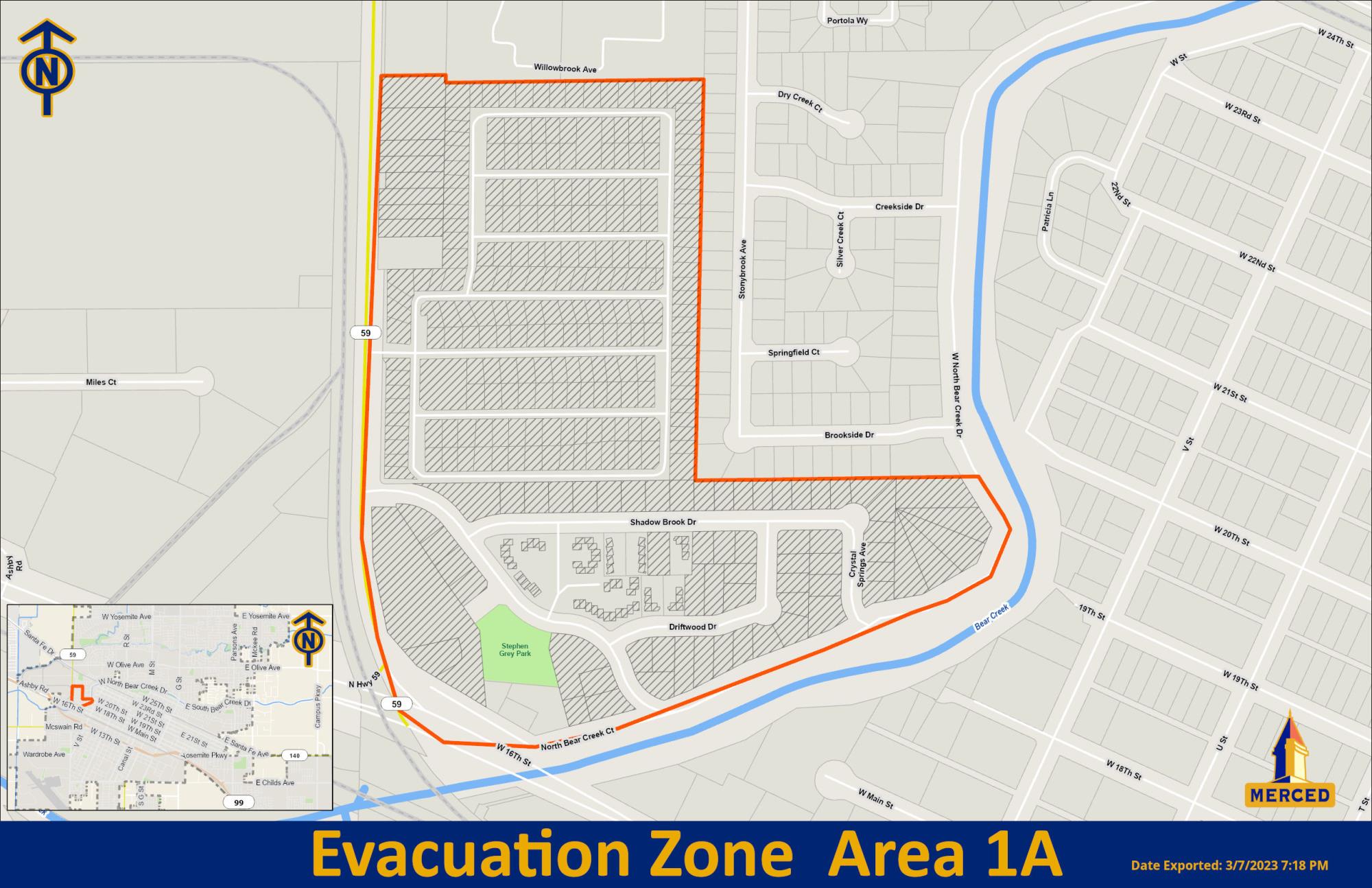
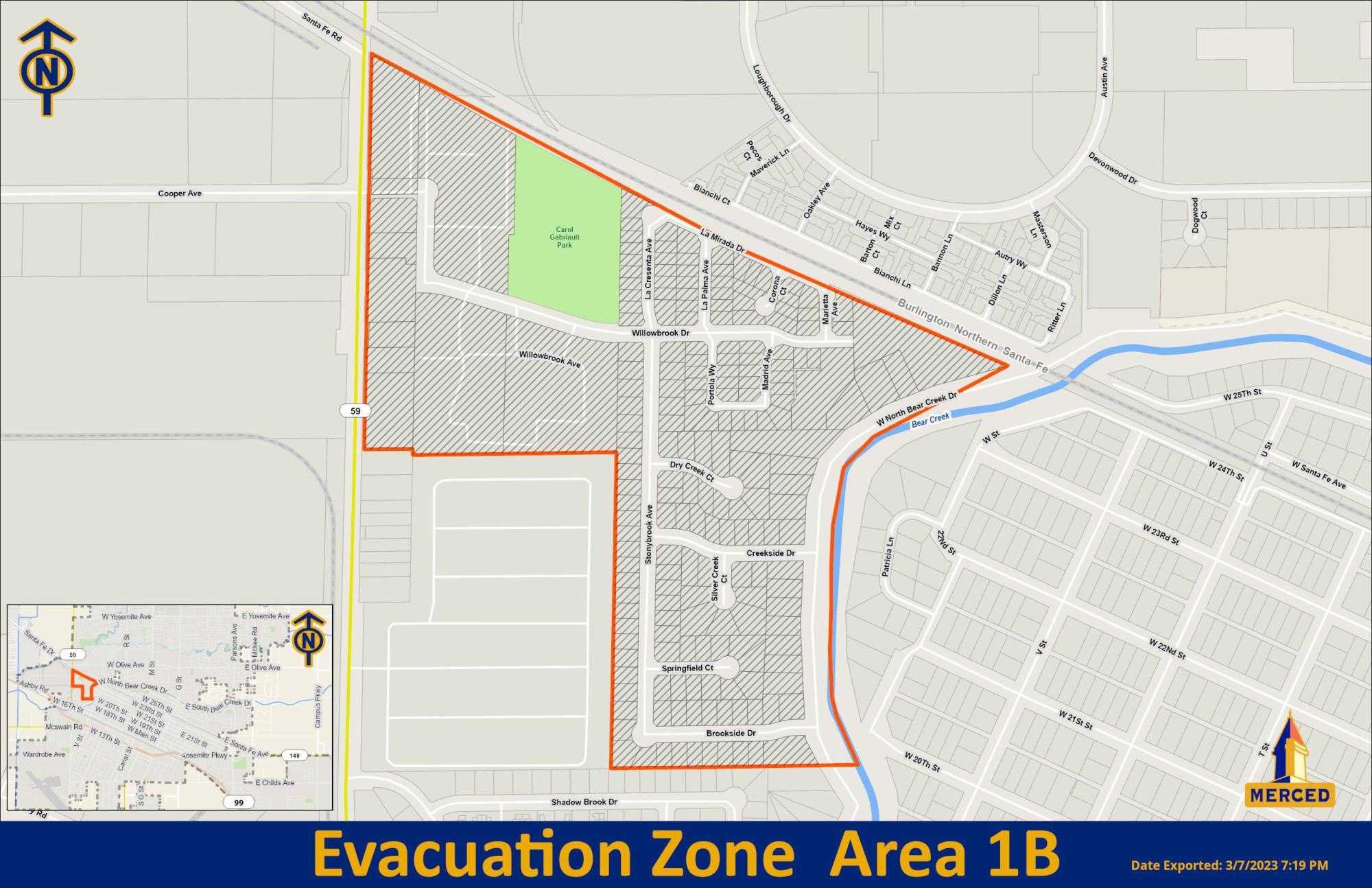
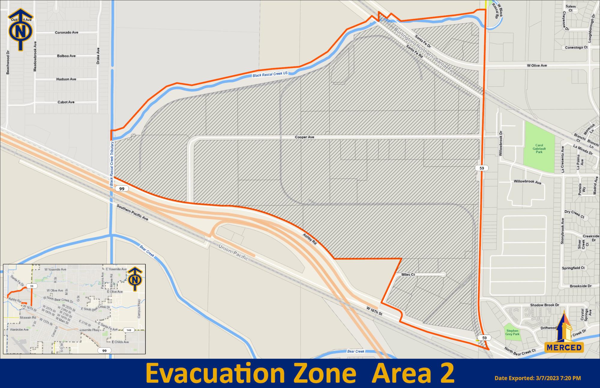
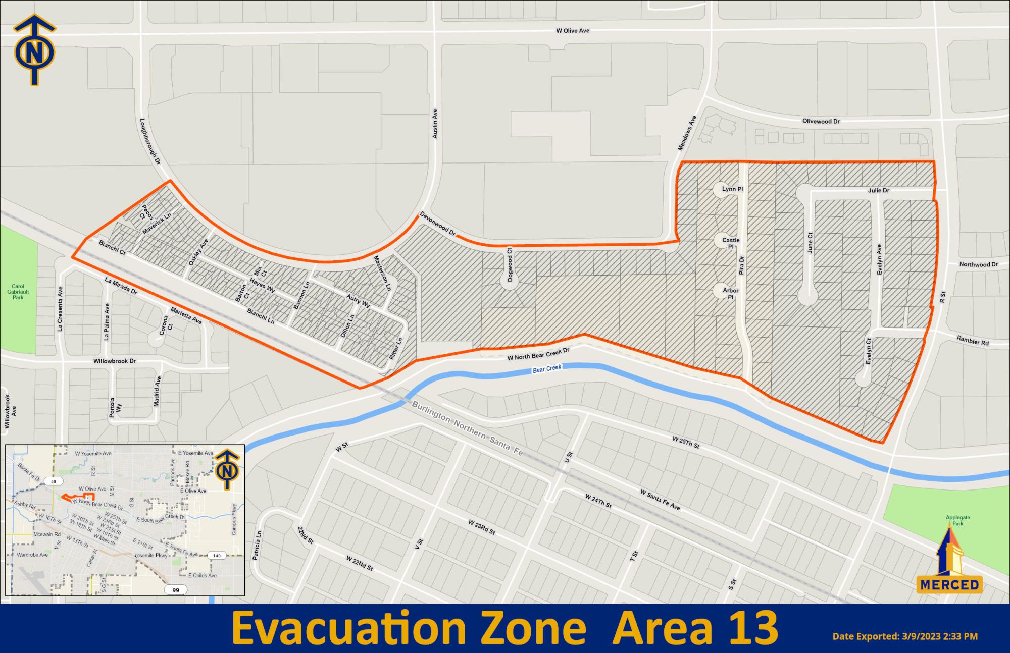
- Evacuation warnings still in place for Areas 1A, 1B, 2, and 13. Evacuation warning area maps are attached.
MERCED, CALIF – (March 13, 2023) – Additional rains and strong winds are expected to begin late Tuesday evening, March 14, 2023, and continue through Wednesday, March 15, 2023. Residents should prepare for possible evacuations around the creek areas.
For weather reports, visit The National Weather Service reports hazardous weather conditions. The City of Merced and outlying communities are under flood watch until March 15, 10 a.m. (PDT). Bear Creek is expected to reach monitor stage Tuesday morning, March 14. The City will continue to update information on the City's website.
Crews continue fortifying areas of Cottonwood, Fahrens, Black Rascal, and Bear Creek affected by previous storms. All creek waters continue to be extremely hazardous. Waters are swift running and cold due to snow melt and runoff. Avoid these waterways. Stay off walking and bike paths around these areas.
Do not drive on flooded streets. Obey all traffic, detour, and roadblock signs. Do not drive around roadblock signs into closed areas. These areas have hazardous conditions. They are closed to protect life and property damage.
The County Emergency Operations Center (EOC) was activated Thursday, March 9, to mitigate potential flooding issues and prepare residents with resources. The City of Merced is a branch of the County’s EOC.
The City and County are under local emergencies. To read the City’s Proclamation of the Existence of a Local Emergency, visit Local Emergency Proclamation. The City Council will ratify the proclamation at a special meeting at 5:30 p.m., Monday, March 13, 2023.
Sandbags
Sandbags are available from 7 a.m. to 4 p.m., Monday through Friday, at The City of Merced Purchasing Building, 2525 O Street. Please enter from O and 25th Streets. Availability will be on a first-come, first-serve basis. For directions to the Purchasing Building and a list of sand locations, visit the City’s Storm Information Webpage. Expect to fill and transport your sandbags. Please bring a shovel. Sandbags are heavy. Please be prepared to lift more than 50 pounds.
To prepare for a possible evacuation.
- Develop a family plan and have emergency telephone numbers available.
- Assemble a disaster supply kit with enough food, water, and other supplies for at least 72 hours. In addition, include essential medicines and life-saving medical equipment. For a complete list, visit https://www.ready.gov/kitPrepare to relocate to a safe location and share your location with family and friends.
- Move vehicles off roadways to allow emergency vehicles access and to prevent flood damage.
If you evacuate:
- Gather all family members.
- Gather all pets.
- Gather essential items, including important documents (insurance policies, identification cards, bank account records, birth certificates, and passports).
- Be sure to bring essential medications and life-saving medical equipment with you.
- Unplug all appliances.
- Move portable appliances and electronics to higher ground.
- Turn off lights in your home.
- Lock your home.
- Move all vehicles off roadways to allow emergency vehicles access and to prevent flood damage.
Shelter Location Information:
- Merced County Fairgrounds: 900 Martin Luther King Jr. Way in Merced (signage will be in place)
- Atwater Community Center: 760 East Bellevue Road in Atwater
Additional Resources:


###